Duck Street
 Duck Street Lane (West Side), Greenhow
Grade 2 Listing, 30-5-1986
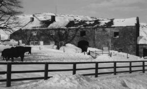
2 cottages with attached barn and outbuildings. Dated 1673, with mid to late 18th century additions and alterations. Coursed gritstone rubble, graduated stone slate roofs. A long south facing range composed of 4 elements:
1. 2 storey, 1 bay baffle-entry cottage with lean-to addition at west end;
2. 2 storey, 2 bay cottage with slightly lower ridge-line;
3. Tall 2 bay barn;
4. 2 storey, 1 bay additional farm outbuilding.
South Front:
- 1 bay 17th century cottage has: board door on right, the left jamb altered, the right jamb of small stones, the lintel with raised inscription “A D 1673” over-painted white with a symbol of a small rectangle with external triangles beneath; to left a 4-light, now 2-light, recessed-chamfered mullion window with dripmould, similar 3-light window above.Lean-to on left: board door with narrow light above. Gable coping on left; end stacks.
- 2-bay cottage has: glazed door in sawn stone surround on right; square 4-pane window in stone surround to left and above.
- Barn: cart entrance with with jambs composed of quoins and tall narrow blocks, segmental arch with voussoires; square opening above; byre door to right, the right jambs forming quoins to former barn end.
- Additional bay entered from east gable end; south front has small window on ground floor and larger opening above; shaped kneeler and gable coping to right.
Interior
C17 door opens onto side of large fireplace with stone stairs against rear wall beyond; the ceiling of the front room has a large spine beam with cyma stops.
Barn: byre has timber stalls with hayloft over; roof has 2 queen-strut trusses with chiselled carpenters marks.
 The building has a complicated history: the C17 cottage may have been larger originally (Report 1977), but conversion to 2 cottages in the mid-late C18 makes interpretation difficult. The buildings may have been linked with the large Greenhow limestone quarry behind, perhaps being used as workmens’ cottages, and the large barn suggests extensive farming activities. The site is also in the middles of the Cockhill and Sunside Head [I presume “Lead” is meant] mining area, extensively worked during the C17 to C19.
B. Jennings (Ed) A History of Nidderdale, 1967, p289. North Yorkshire and Cleveland Vernacular Buildings Study Group Report Number 452 (1977)
Above is the entry in the council’s book of listed properties.
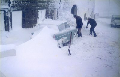
Winter 1984
Digging out on a Monday morning
to go to work.
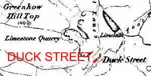
Map image produced from the www.old-maps.co.uk service with permission of Landmark Information Group Ltd and Ordnance Survey
Occupiers (head of household)
1789 – John Joy (~1762)
1795 – Edward Whitehead (1771-)
1800 – Edward Whitehead (1771-)
1804 – John Whitehead (~1782)
1861 – Thomas Longthorn (1815-1896)
1881 – Richard King (1817-1884)
1891 – William Whitehead (1879-1955)
1911 – Joseph Mackwell (1856-1926)
1939 – George Gill (owner of Stump Cross Caverns)
