Castle Hill

House dated INEN 1662
John Rawson bought the property in 1874
It is now 2 dwellings
From the historical notes on the Church at Sowerby, by Graptolite:
"The site of an old fort or castle at the head of the village has been thought to be Roman, though it is not known when it was built or destroyed. On its site Castle Farm is yet standing"
The site of the castle was in the field immediately to the north of the building and is clearly shown on Ordnance Survey maps as a mound. There was an archaeolgical dig carried in the early 1900's by the Halifax Antiquarian society, at the instigation of the Rawson family. The castle in Sowerby had been described as a Timber Castle but only the earthworks remain.
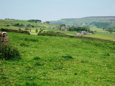
The castle appears to have been the "Look Out" type, in that it is situated on a small level area in a prominent observational position, facing North it is on the south side of the valley where it had commanding views to the east the west and to the North of the valley. Its position on the hill also gave it a paternal view over the Village.
The "Castle" survives as a barely discernable mound. The mound measured approximately 20 yards in diameter and survives to a height of about 18 inches. on the north side and practically nothing on the southern side. The ditch has all but disappeared. A break in the outer bank of the ditch on the south west side probably indicated a causeway that may have been connected to the "Roman road", which according to some historians came down Rooley lane.
The mound is the site of a castle which is thought to have belonged to the Earls of Warren. The name Castle Hill has been used to describe the site since 1309 and is a scheduled monument.
By John Kerridge
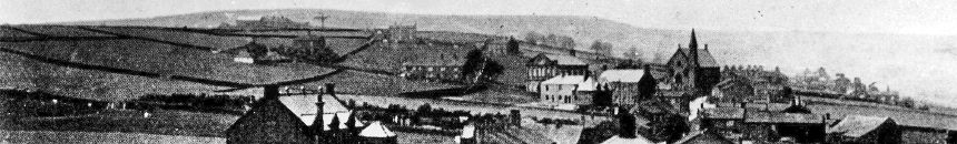
For the location please see the main village photograph